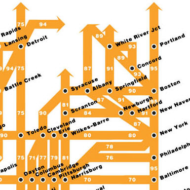
Chris Yates has created a map of the Eisenhower Interstate System, simplified as a subway-style infographic. If you’re traveling to one of the top few dozen largest cities in the US, it’s all you’ll ever need.
Link
Chris Yates has created a map of the Eisenhower Interstate System, simplified as a subway-style infographic. If you’re traveling to one of the top few dozen largest cities in the US, it’s all you’ll ever need.
Link


0 Responses to “US interstate system, done tube-style”